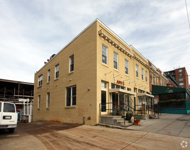
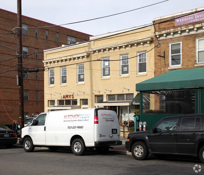
Property Record
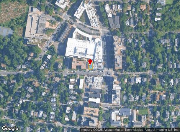
3715 Macomb St Nw, Washington, DC 20016

NEARBY LISTINGS FOR SALE OR LEASE
Property Detail
3715 Macomb St Nw
Washington-Arlington-Alexandria, DC-VA-MD-WV
Cleveland Park
1920-0059
SQUARE 1920 LOT 0059 NBHD: CLEVELAND PARK
Restaurantbuilding
District of Columbia
X
District of Columbia
1100010012C
59
2025
0.08 AC
2025
Uptown
001002
Washington, DC
8,050 SF
DEMOGRAPHICS near 3715 Macomb St Nw
1 Mile
3 Mile
5 Mile
2024 Total Population
32,838
286,979
679,828
2029 Population
29,549
263,641
640,259
Pop Growth 2024-2029
(10.02%)
(8.13%)
(5.82%)
Average Age
41
39
38
2024 Total Households
17,813
139,032
318,246
HH Growth 2024-2029
(10.92%)
(8.94%)
(6.43%)
Median Household Inc
$123,264
$123,059
$119,662
Avg Household Size
1.80
1.90
2.00
2024 Avg HH Vehicles
1.00
1.00
1.00
Median Home Value
$885,356
$910,641
$847,729
Median Year Built
1952
1955
1963
Nearby Places
Map Layers
Map Styles
 Street
 Aerial
- Restaurants
- Banks
- Shops
- Fitness
- Groceries
PUBLIC TRANSPORTATION
TRANSIT/SUBWAY
Cleveland Park (Red Line - Washington Metropolitan Area Transit Authority Metrorail (Metrorail))
DRIVE
WALK
Distance
Cleveland Park (Red Line - Washington Metropolitan Area Transit Authority Metrorail (Metrorail))
3 min
19 min
1.0 mi
COMMUTER RAIL
4 (Fredericksburg Line - Virginia Railway Express, Manassas Line - Virginia Railway Express)
DRIVE
WALK
Distance
4 (Fredericksburg Line - Virginia Railway Express, Manassas Line - Virginia Railway Express)
10 min
5.4 mi
L'enfant (Fredericksburg Line - Virginia Railway Express, Manassas Line - Virginia Railway Express)
DRIVE
WALK
Distance
L'enfant (Fredericksburg Line - Virginia Railway Express, Manassas Line - Virginia Railway Express)
10 min
5.4 mi
AIRPORT
Ronald Reagan Washington Ntl
DRIVE
WALK
Distance
Ronald Reagan Washington Ntl
15 min
7.7 mi
Washington Dulles International
DRIVE
WALK
Distance
Washington Dulles International
43 min
23.5 mi
Baltimore/Washington International Thurgood Marshall
DRIVE
WALK
Distance
Baltimore/Washington International Thurgood Marshall
52 min
36.8 mi
Freight Ports
Port of Baltimore
DRIVE
WALK
Distance
Port of Baltimore
56 min
39.7 mi
Nearby Properties
Address
Land Use
TOTAL SIZE
Lot Size
Zoning
Address
Land Use
TOTAL SIZE
Lot Size
Zoning
2,455,000 SF
11.08 AC
MU-2
Address
Land Use
TOTAL SIZE
Lot Size
Zoning
1,100,000 SF
2.13 AC
D-6
Address
Land Use
TOTAL SIZE
Lot Size
Zoning
1,310,661 SF
3.38 AC
D-6
Address
Land Use
TOTAL SIZE
Lot Size
Zoning
1.57 AC
D-5
Address
Land Use
TOTAL SIZE
Lot Size
Zoning
553,914 SF
55.91 AC
R-1B
Address
Land Use
TOTAL SIZE
Lot Size
Zoning
1,185,122 SF
2.43 AC
D-6
Address
Land Use
TOTAL SIZE
Lot Size
Zoning
1,214,044 SF
1.48 AC
D-6
Address
Land Use
TOTAL SIZE
Lot Size
Zoning
469,183 SF
1.20 AC
D-5
Address
Land Use
TOTAL SIZE
Lot Size
Zoning
900,000 SF
12.60 AC
RA-4
Address
Land Use
TOTAL SIZE
Lot Size
Zoning
77.26 AC
R-3/GT
Address
Land Use
TOTAL SIZE
Lot Size
Zoning
636,768 SF
1.91 AC
C-O-ROSSLY
Address
Land Use
TOTAL SIZE
Lot Size
Zoning
247,900 SF
170.58 AC
RA-2;UNZON
Address
Land Use
TOTAL SIZE
Lot Size
Zoning
1,018,056 SF
1.14 AC
D-6
Address
Land Use
TOTAL SIZE
Lot Size
Zoning
776,520 SF
1.49 AC
MU-9B
Address
Land Use
TOTAL SIZE
Lot Size
Zoning
1,365,427 SF
2.62 AC
MU-9B;RA-4
Address
Land Use
TOTAL SIZE
Lot Size
Zoning
499,000 SF
1.49 AC
RA-4
Address
Land Use
TOTAL SIZE
Lot Size
Zoning
400,000 SF
1.30 AC
RA-4
Address
Land Use
TOTAL SIZE
Lot Size
Zoning
431,570 SF
0.78 AC
D-6
Address
Land Use
TOTAL SIZE
Lot Size
Zoning
430,428 SF
0.76 AC
D-6
Address
Land Use
TOTAL SIZE
Lot Size
Zoning
550,211 SF
1.42 AC
D-6
Address
Land Use
TOTAL SIZE
Lot Size
Zoning
482,000 SF
1.17 AC
MU-9B;RA-4
Address
Land Use
TOTAL SIZE
Lot Size
Zoning
502,963 SF
0.84 AC
D-6
Address
Land Use
TOTAL SIZE
Lot Size
Zoning
Address
Land Use
TOTAL SIZE
Lot Size
Zoning
45,523 SF
0.24 AC
C-O-ROSSLY
Address
Land Use
TOTAL SIZE
Lot Size
Zoning
795,214 SF
MU-5A
Address
Land Use
TOTAL SIZE
Lot Size
Zoning
1,095,275 SF
30.70 AC
MU-4;RA-2
Address
Land Use
TOTAL SIZE
Lot Size
Zoning
4.67 AC
MU-13;MU-1
Address
Land Use
TOTAL SIZE
Lot Size
Zoning
0.77 AC
D-6
The World's #1 Commercial Real Estate Marketplace
Connect with us
© 2025 CoStar Group
The information above has been obtained from sources believed reliable. While we do not doubt its accuracy we have not verified it and make no guarantee, warranty or representation about it. It is your responsibility to independently confirm its accuracy and completeness. Any projections, opinions, assumptions, or estimates used are for example only and do not represent the current or future performance of the property. The value of this transaction to you depends on tax and other factors which should be evaluated by your tax, financial, and legal advisors. You and your advisors should conduct a careful, independent investigation of the property to determine to your satisfaction the suitability of the property for your needs.